Matuka is an advanced copper exploration project in the Central Province of Zambia, held under Large-Scale Exploration Licence 34992-HQ-LEL (granted April 2024, 45.39 km²), one of three adjacent licences held by Iimba Enterprises Ltd and advanced in joint venture with Jimbe Minerals. The project sits on the boundary of the Mkushi and Kapiri Mposhi Districts, approximately 10 km north-west of the operating Mkushi Copper Mine, with year-round access from the T2 tarred highway.
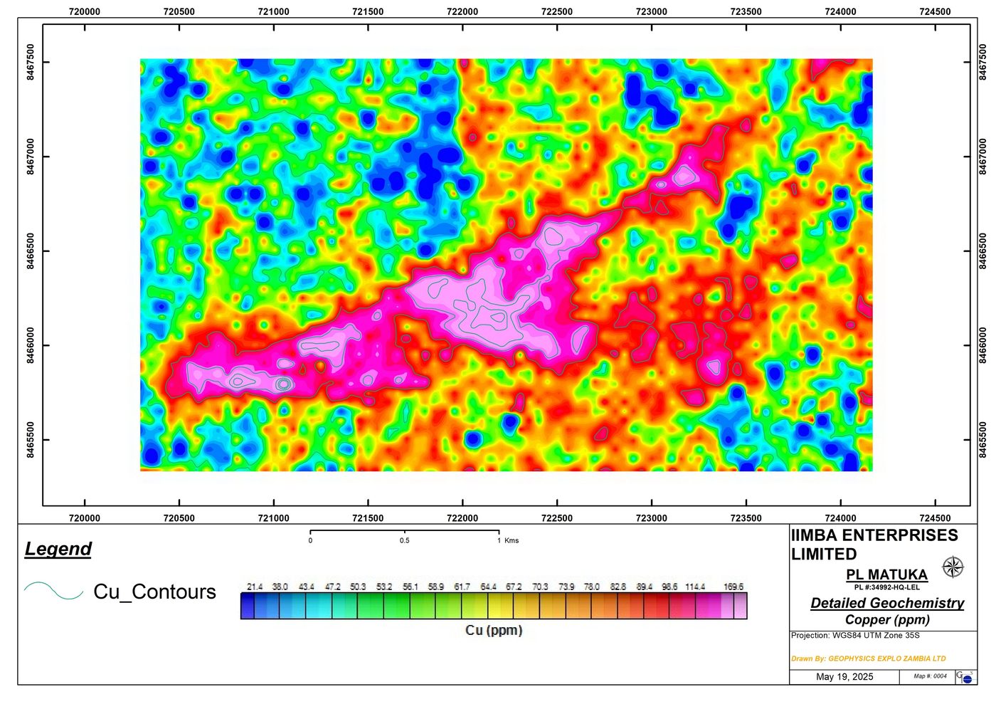
Modern, systematic exploration — 3,612 detailed soil samples, 50 line-km of induced polarisation, 150 line-km of ground magnetics and 80 line-km of radiometrics — has defined a 3.3 km ENE-striking copper anomaly with coincident zinc and lead, peaking at 887 ppm Cu in soils, sitting directly over chargeable, conductive IP responses within a magnetic-low shear zone.
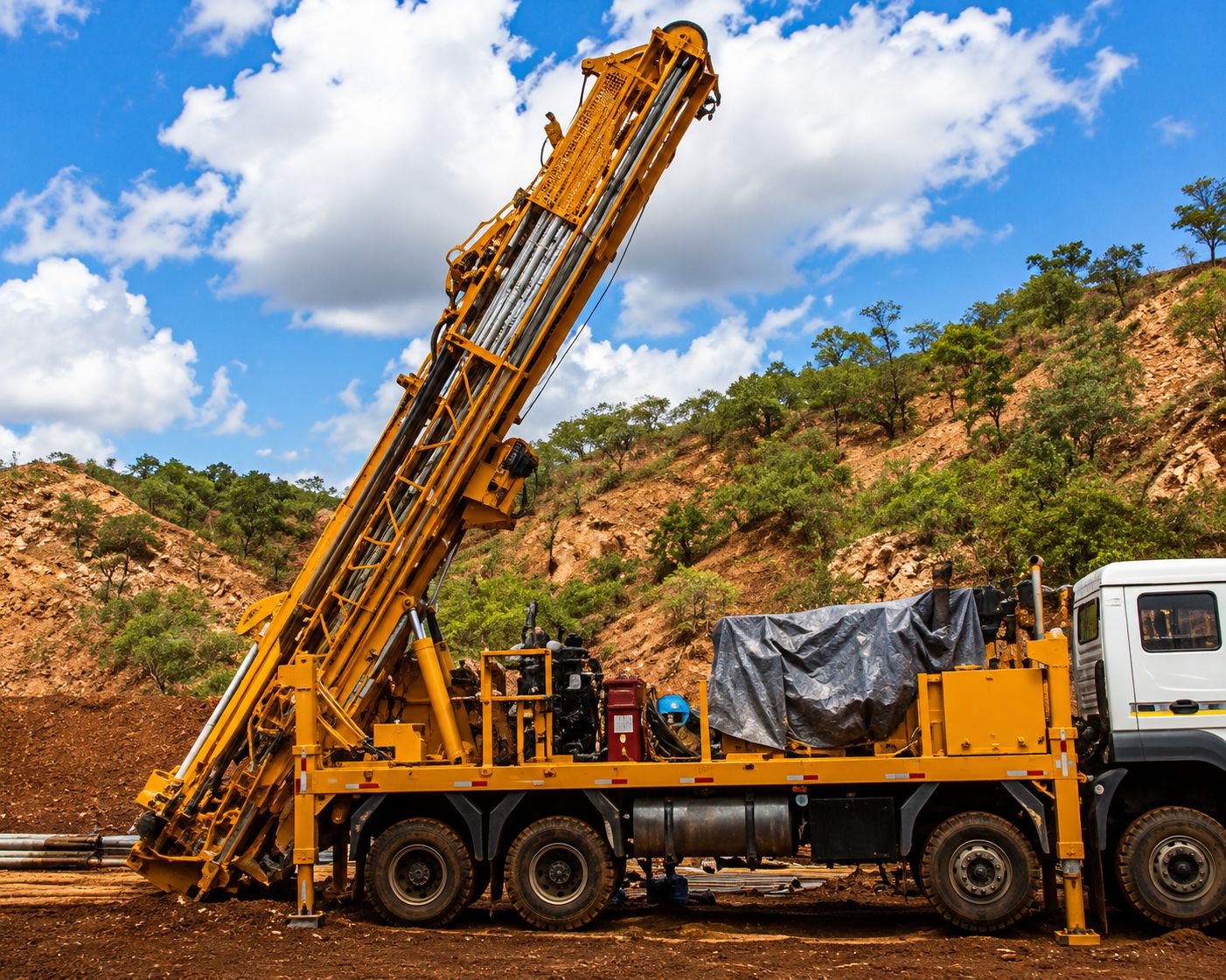
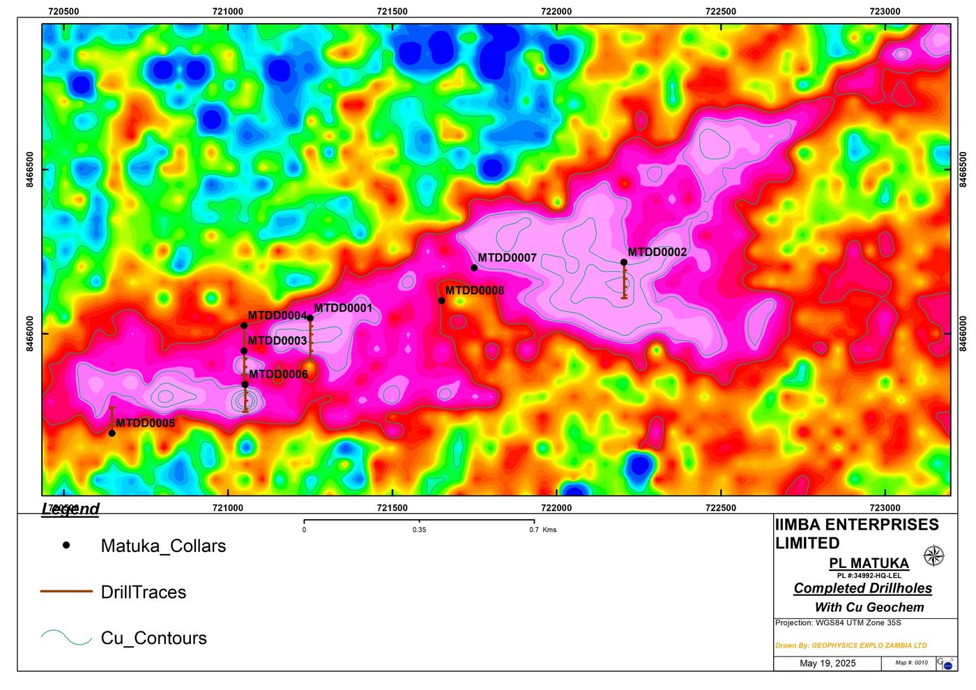
First-pass diamond drilling has intersected copper mineralisation in seven of eight holes (1,749.6 m) — chalcopyrite with pyrite in disseminations, veins and along foliation in altered, sheared gneiss and schist. Only 1.2 km of the 3.3 km trend has been drill-tested to date. These are exploration results; no mineral resource has been declared and no economic assessment has been undertaken.
Historical, Completed, Ongoing and Planned Work
Drilling has confirmed copper mineralisation. It has not established a mineral resource, a mineral reserve, or economic viability.
Ten Kilometres from an Operating Copper Mine
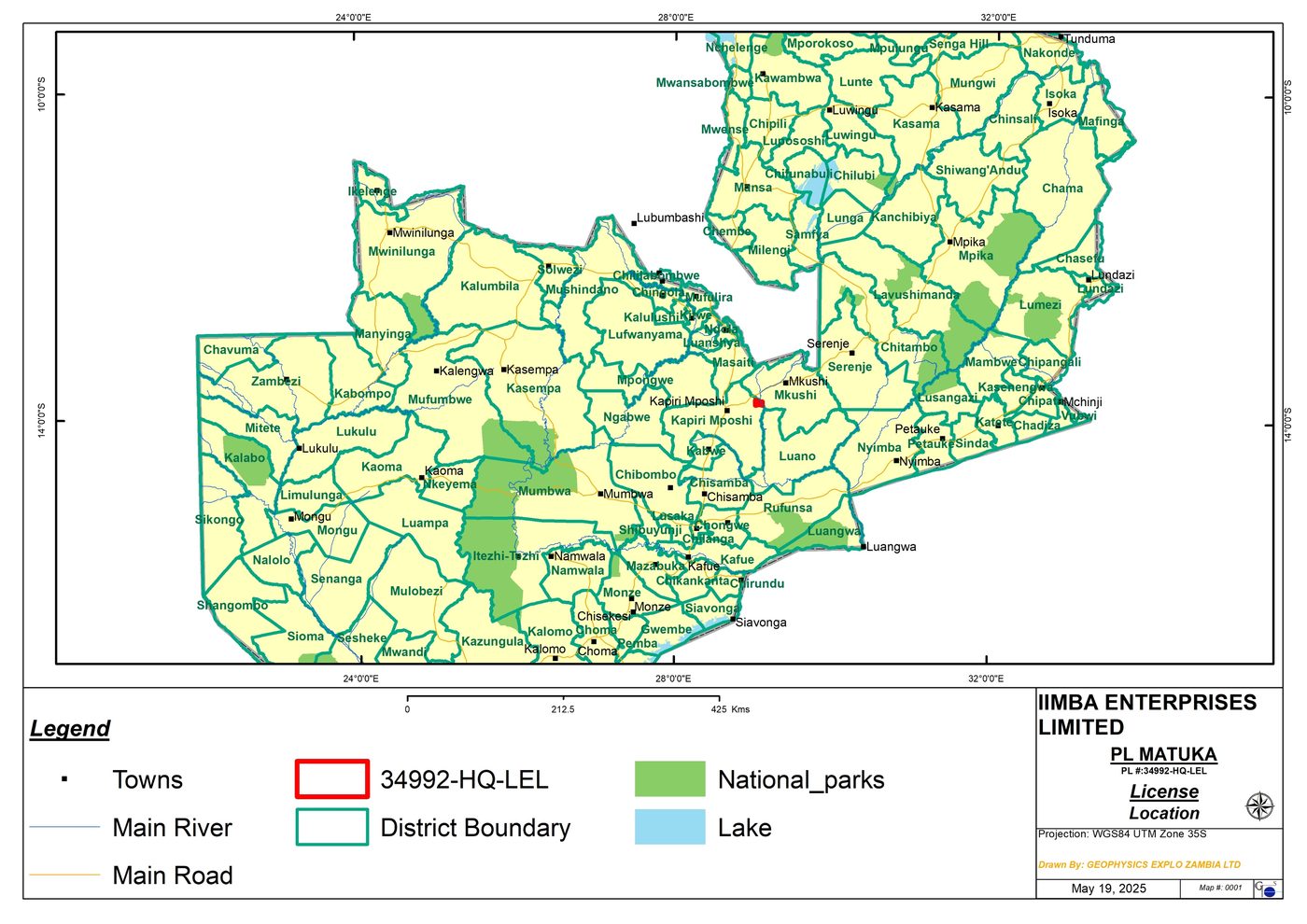
The project straddles the boundary of the Mkushi and Kapiri Mposhi Districts, 34 km north-east of Kapiri Mposhi town and 35 km south-west of Mkushi town. The operating Mkushi Copper Mine lies approximately 10 km to the south-east, evidencing copper endowment in the district. No inference as to grade or tonnage at Matuka is drawn from that proximity.
Access is straightforward: the T2 Kapiri Mposhi–Nakonde tarred highway with a branch onto the D209 gravel road delivers year-round, all-season access to the licence — a practical advantage for drilling and any future development.
Shear-Hosted Copper in the Irumide Belt
Matuka lies at the south-western end of the Mesoproterozoic Irumide Belt, a northeast-trending fold-and-thrust belt. The licence is underlain by the Mkushi Gneiss Formation — banded and porphyroblastic gneisses intruded by granites, aplites and pegmatites along NE-trending shear zones — overlain by schists of the Muva Supergroup. A copper–zinc occurrence within the tenement was mapped by the Zambian Geological Survey.
Ground magnetics show the copper anomaly is confined to a magnetic-low shear corridor cross-cut by NW and NE faults, while radiometrics reveal elevated potassium over the trend — a signature consistent with hydrothermal alteration associated with a mineralising system. Copper occurs as chalcopyrite with chlorite alteration in schist and silicification in gneiss.
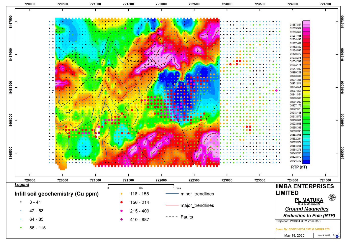
A 3.3 km Copper Trend, Defined by Four Independent Datasets
Seven of Eight Holes Intersected Copper
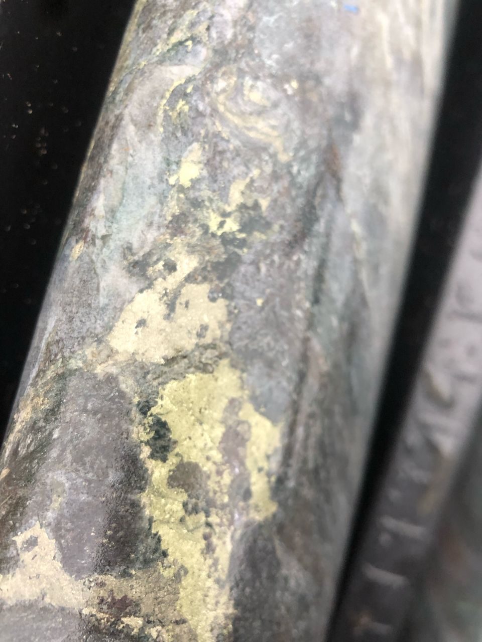
The maiden drilling programme tested coincident soil-geochemical and IP anomalies with eight diamond drillholes totalling 1,749.6 m. Seven intersected copper mineralisation — chalcopyrite occurring with pyrite as disseminations, veins, along foliation planes and as massive blebs on fractures — with appreciable associated zinc. Massive pyrite–pyrrhotite was intersected below the main zone, and drill core was assayed by ALS for multi-element analysis.
Mineralisation has been confirmed along only 1.2 km of the 3.3 km anomaly. The remaining 2.1 km of strike — including drill targets originally generated by African Eagle Resources but never tested — remains to be evaluated by the planned drilling programme.
Technical Documentation — Available Under NDA
Drill logs, ALS assay certificates, the complete geophysical datasets (IP, magnetics, radiometrics) and the historical African Eagle exploration database are made available to qualified investors through our secure data room following execution of a confidentiality agreement.
Private investors: the portfolio is open to private participation — see the Investment Opportunity.