Jimbe Minerals Investor Centre ↗
Flagship Project · Large-Scale Mining Licence

Jimbe Copper–Nickel Project

A 249 km² licensed tenement in Zambia's copper-rich North-Western Province, targeting magmatic copper–nickel sulphide mineralisation at the Zambia–Angola–DRC tri-border.

The Jimbe Project is the flagship asset of the Jimbe Minerals portfolio and the first systematic exploration undertaken in this district. In the same province that hosts the Lumwana and Kansanshi copper mines, the Project holds a granted Large-Scale Mining Licence (No. 17894-HQ-LML) permitting copper and a full suite of associated metals, advanced through gridded geochemistry, 17 diamond drillholes and an approved Environmental Impact Statement — with drill-ready copper–nickel sulphide targets defined.

Exploration Highlights → Investor Data Room →
Licence
LML 17894-HQ-LML
Area
approximately 249 km²
Tenure
Valid to December 2039
Commodities
Cu · Ni · Co · Au
Stage
Advanced Exploration
EIS Status
ZEMA Approved (2014)
Executive Summary

The Jimbe Project is held under Large-Scale Mining Licence No. 17894-HQ-LML, granted by the Zambian Ministry of Mines and Minerals Development on 15 December 2014 and valid to December 2039. The licence covers approximately 249 km² in the Ikelenge District of North-Western Province — Zambia's fastest-growing copper region, home to the Lumwana and Kansanshi mines — and permits the exploitation of copper, nickel, cobalt, chromium, gold, silver, titanium, vanadium and rare earth elements.

Exploration at Jimbe has targeted magmatic copper–nickel sulphide mineralisation from the outset. Two phases of gridded soil geochemistry totalling more than 8,700 samples, followed by a 17-hole, 2,754 m diamond drilling campaign, have defined four discrete targets: Kamafumbo, Salujinga and Nkalamu (copper–nickel–chromium anomalism over mafic/ultramafic terrain) and Mukanjila (a secondary rare-earth target in granitic terrain). Drilling intersected a previously unmapped mafic–ultramafic intrusive complex on the trend of the Kabanga–Musongati–Kapalagulu belt — a geological setting that hosts major nickel–copper sulphide deposits in Tanzania and Burundi.

The Project's Environmental Impact Statement was approved by the Zambia Environmental Management Agency in September 2014, and an Environmental and Social Management Plan aligned with IFC Performance Standards is in place — giving the Project a rare combination for a greenfield asset: granted mining tenure, environmental approval, and defined drill-ready targets.
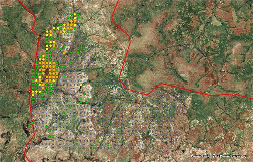
Satellite view of the Jimbe licence area with superimposed soil geochemistry sampling
Satellite view of the Jimbe licence with superimposed soil geochemistry (Aurum Exploration Services, 2010).
Project Status Summary

What Is Granted, What Is Historical, What Is Planned

No mineral resource or mineral reserve has been declared on the Project, and no assessment of economic viability has been completed. The table below states the status of each element of work.

Large-Scale Mining Licence No. 17894-HQ-LML granted (valid to December 2039)
Granted
Environmental Impact Statement approved by ZEMA (September 2014)
Completed
Two gridded soil geochemistry campaigns — 8,754 samples
Completed
17 diamond drillholes at Kamafumbo, 2,754 m (2011)
Historical Evidence
Environmental and Social Management Plan aligned with IFC Performance Standards
Ongoing
Community engagement under the consent of Chief Nyakaseya
Ongoing
3D geological and mineralisation model — Kamafumbo
Planned
Deferred Salujinga diamond drilling and Nkalamu trenching
Planned
Mukanjila rare-earth trenching and RC drilling
Planned
Maiden mineral resource estimation programme
Planned
Full technical documentation, drill logs and assay databases
Available on Request
Geological Setting

Copper–nickel sulphide potential in the province that hosts Zambia’s Lumwana and Kansanshi copper mines.

Learn More →
Exploration Results

A 12 km copper–nickel anomaly corridor, 17 diamond holes and four defined targets across the licence.

Learn More →
Forward Programme

A staged work plan designed to advance Kamafumbo toward a maiden mineral resource.

Learn More →
Permitting & ESG

Granted mining licence, approved EIS, and an ESMP aligned with IFC Performance Standards.

Learn More →
Location & Access

The Zambia–Angola–DRC Tri-Border

The Project sits in the Mwinilunga/Ikelenge District of North-Western Province, its western boundary defined by the Jimbe River on the Angolan border and its north by the DRC frontier. Access is via daily domestic flights to Solwezi and the state-maintained T5 highway to Mwinilunga.

Regional power is supplied by the Zengamina hydroelectric plant near Kalene Hill — clean, low-cost generation currently operating below capacity — while skilled labour and specialised services are available from Solwezi, Ndola and Lusaka.
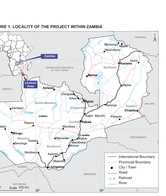
Locality of the Jimbe Project within Zambia, North-Western Province
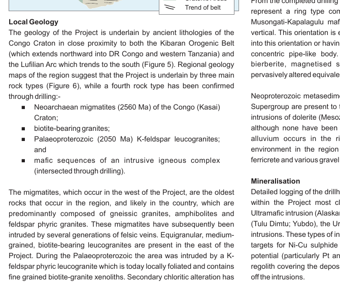
Property-specific geology map of the Jimbe Project
Property geology: Neoarchaean migmatites and mafics, leucogranites and Neoproterozoic cover sequences.
Geological Setting

Copper Country: Between the Copperbelt and a Proven Sulphide Belt

The Project is underlain by ancient lithologies of the Congo Craton, in close proximity to the Lufilian Arc that hosts the Central African Copperbelt to the south-east — the province where copper is mined at Lumwana, Kansanshi and Kalumbila — and to the Kibaran Orogenic Belt. Copper and nickel soil anomalism within the migmatite zone, first identified by independent consultants Aurum Exploration Services, pointed to possible magmatic sulphide mineralisation and drove the drill targeting.

Diamond drilling confirmed a previously unmapped mafic–ultramafic intrusive complex on the trend of the Kabanga–Musongati–Kapalagulu belt — the same geological trend hosting major nickel–copper sulphide deposits in Tanzania and Burundi — with precious-metal enrichment identified in the weathering profile as an additional value driver.
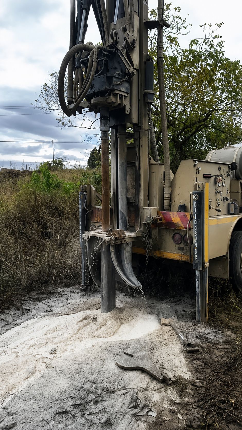
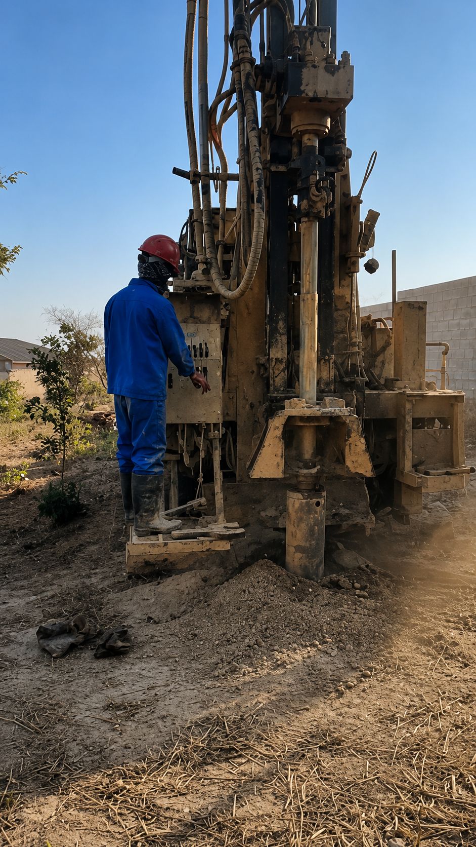
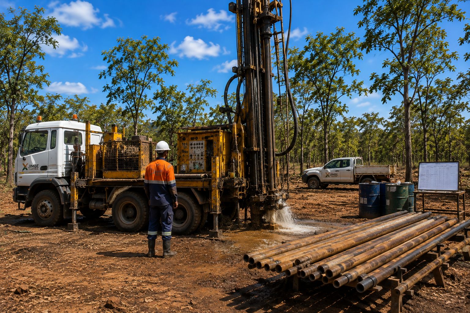
Illustrative photograph of a diamond drill rig Illustrative photograph of a drilling rig Illustrative photograph of water return at the collar during diamond drilling
Exploration Results

A Drill-Tested Copper–Nickel Sulphide System. Four Defined Targets.
8,754
Soil geochemistry samples across two gridded campaigns
17
Diamond drillholes completed at Kamafumbo (2011)
2,754 m
Total metres drilled — deepest hole 608.6 m
>1% Ni
Multiple intersections from the copper–nickel sulphide target, assayed by ALS
12 km
Long copper–nickel soil anomaly corridor in the migmatite zone (up to 3 km wide)
Nickel and rubidium soil geochemistry grids with completed and planned diamond drillhole locations
100 m × 100 m infill soil geochemistry (Ni and Rb) with completed diamond drillholes at Kamafumbo and planned holes at Salujinga.
Kamafumbo — Cu-Ni Sulphide Target
The most advanced target: a drill-confirmed mafic/ultramafic intrusion within the copper–nickel anomaly corridor, with intersections above 1% Ni and precious-metal enrichment in the weathering profile. Priority area for 3D geological modelling and resource-definition drilling.
Nkalamu — Cu · Ni · Cr
Copper–nickel–chromium soil anomalism in migmatitic/mafic terrain — the most copper-enriched of the mafic targets — to be tested by trenching ahead of first-pass drilling.
Salujinga — Ni · Cr (Cu)
Coincident nickel–chromium soil anomalism over mafic terrain. Diamond drillholes were planned and positioned in 2011 but deferred by seasonal rains — a ready-to-drill target.
Mukanjila — REE (secondary)
A discrete rare-earth target of approximately 1 km² in granitic terrain in the south-east of the licence — a secondary, non-core opportunity that adds optionality beyond the copper–nickel focus.
Forward Work Programme

The Path Toward a Maiden Resource

01
3D geological & mineralisation model — Kamafumbo
Planned
Integrate the downhole geological logging and assay database into a 3D model to define the geometry of the intrusion and rank drill targets.
02
Complete the deferred Salujinga drilling
Planned
Execute the planned diamond drilling at Salujinga and trenching at Nkalamu to confirm the nickel potential of both target areas.
03
REE trenching & RC drilling — Mukanjila
Planned
Trench across the anomalous REE targets in conjunction with shallow, cost-effective RC drilling to obtain clean, voluminous samples for full rare-earth assay.
04
Resource estimation programme
Planned
Advance the Kamafumbo dataset toward a maiden, code-compliant mineral resource estimate — the trigger for feasibility studies and mine planning under the conditions of the mining licence.

The Project is a greenfield exploration asset. No Mineral Resource or Mineral Reserve compliant with an internationally recognised reporting code has been declared, no mineral reserve or economic viability has been established, and the forward programme described above is planned work designed to progress the Project toward that milestone. Forward-looking statements are subject to exploration risk.

Permitting & ESG

Permitted for the Current Stage of Work

2012
Completed
Environmental Project Brief approved
ZEMA approved the EPB for prospecting activities within the Project in January 2012.
2013–14
Completed
Full ESIA completed
Environmental and Social Impact Assessment prepared by African Mining Consultants under the Environmental Management Act and MMDA.
2014
Completed
EIS approved by ZEMA
The Environmental Impact Statement for the proposed mining operation was approved in September 2014, subject to standard conditions.
Ongoing
Ongoing
ESMP to IFC standards
An Environmental and Social Management Plan aligned with IFC Performance Standards and World Bank policies, with community engagement under the consent of Chief Nyakaseya.
Investor Data Room

Technical Documentation — Available Under NDA

Complete technical documentation — including independent technical review and valuation reporting, the full Environmental Impact Statement, drill logs, assay databases and geochemical datasets — is made available to qualified investors through our secure data room following execution of a confidentiality agreement.

Independent Technical Review & Valuation
SAMVAL-compliant, 2015
On Request
Environmental Impact Statement
Full ESIA & ZEMA decision letter
On Request
Drill Logs & Assay Database
17 holes · downhole logging
On Request
Geochemical Datasets & Maps
Regional + infill soil grids
On Request
Corporate & Investor Presentation
Current overview deck
On Request

Private investors: the portfolio is open to private participation — see the Investment Opportunity.

Request Data Room Access →

Frequently Asked Questions

What stage is the Jimbe Project?
Jimbe is an advanced greenfield exploration project. It holds a granted Large-Scale Mining Licence valid to December 2039 and an approved EIS, with drilling completed at Kamafumbo, but no code-compliant mineral resource has been declared.
Is the project producing?
No. The Project is not an operating mine. The current focus is follow-up exploration intended to define a maiden mineral resource, which would in turn justify feasibility studies and mine planning.
What commodities is Jimbe prospective for?
Jimbe is explored as a magmatic copper–nickel sulphide project. The licence permits exploitation of copper, nickel, cobalt, chromium, gold, silver, titanium, vanadium and rare earth elements. Drilling to date has tested the copper–nickel anomaly corridor at Kamafumbo, where nickel intersections above 1% were returned.
How do I access the technical reports?
Detailed technical documentation is provided to qualified investors through our secure data room following execution of a confidentiality agreement. Use the Request Data Room Access link above or contact our team.
Related Projects
All Projects → Why Zambia → Investor Centre → Sustainability →